25 “Western” Miles*
It started as a selfish idea. How could I see more of this great planet while my body was still capable of getting to the hard-to-reach locations I wanted to see? Family obligations, work, church, school, and youth sports all conspire to fill up the calendar. Good things, but before you know it, you’ve got nothing left. So then, how to recharge? For me, the Great Battery is found outside, somewhere I can be alone with His heavens, mountains, and seas. John Lubbock said it best:
“Rest is not idleness, and to lie sometimes on the grass under trees on a summer’s day, listening to the murmur of the water, or watching the clouds float across the sky, is by no means a waste of time.”
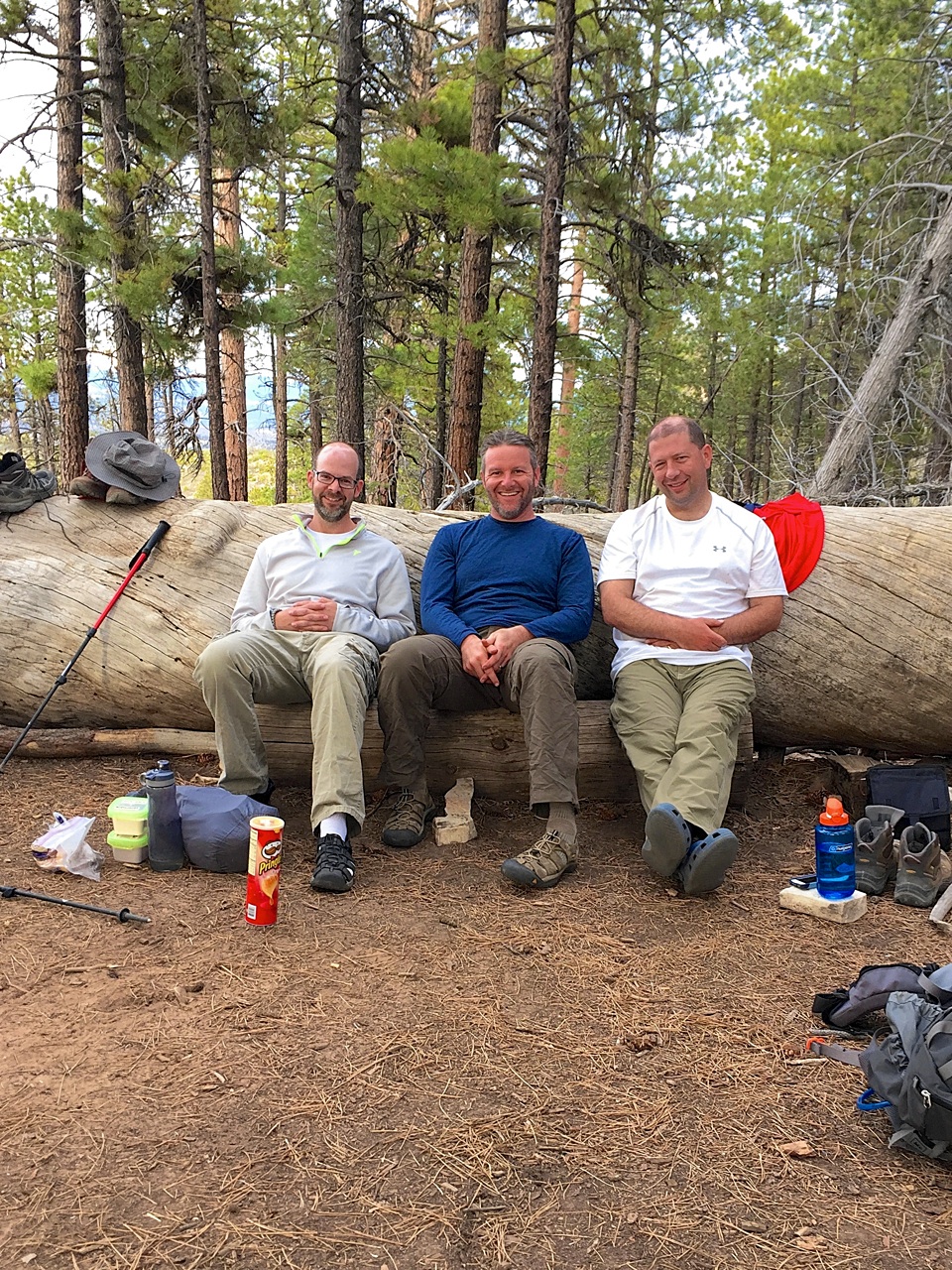
I got the backpacking bug a few years ago while on a backcountry trip in Alaska. My friend Chad went on that trip, so I figured he’d be up for another go round. We talked it over and decided to invite a few others. Next, we had to decide where to go and when our schedules might align for a long weekend. Deciding where to go was the easy part — Zion National Park was on everyone’s short list. But when to go? A preposterously difficult decision. As luck would have it, Darren would be in Las Vegas on a business trip in late April. Could we piggy-back a trip to Utah onto his itinerary? We didn’t hit the jackpot, but at least four of us could make it work.
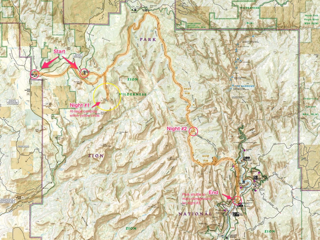
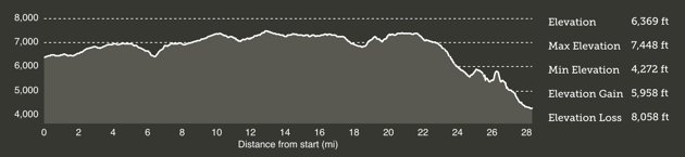
With an agreed upon destination and date, the planning kicked into high-gear. My retirement dream-job is to work as a ranger/interpreter/guide at a big park somewhere. Might as well see if I’m cut out for that now, right? I charted a 25-mile point-to-point backcountry route on the park’s western side that would require three days. We’d wander through four diverse biomes: Desert, riparian, woodlands, and coniferous forest. We’d start high (6,369-ft), climb higher (7,133-ft), and then descend to 4,272-ft by the time we reached Zion Canyon.
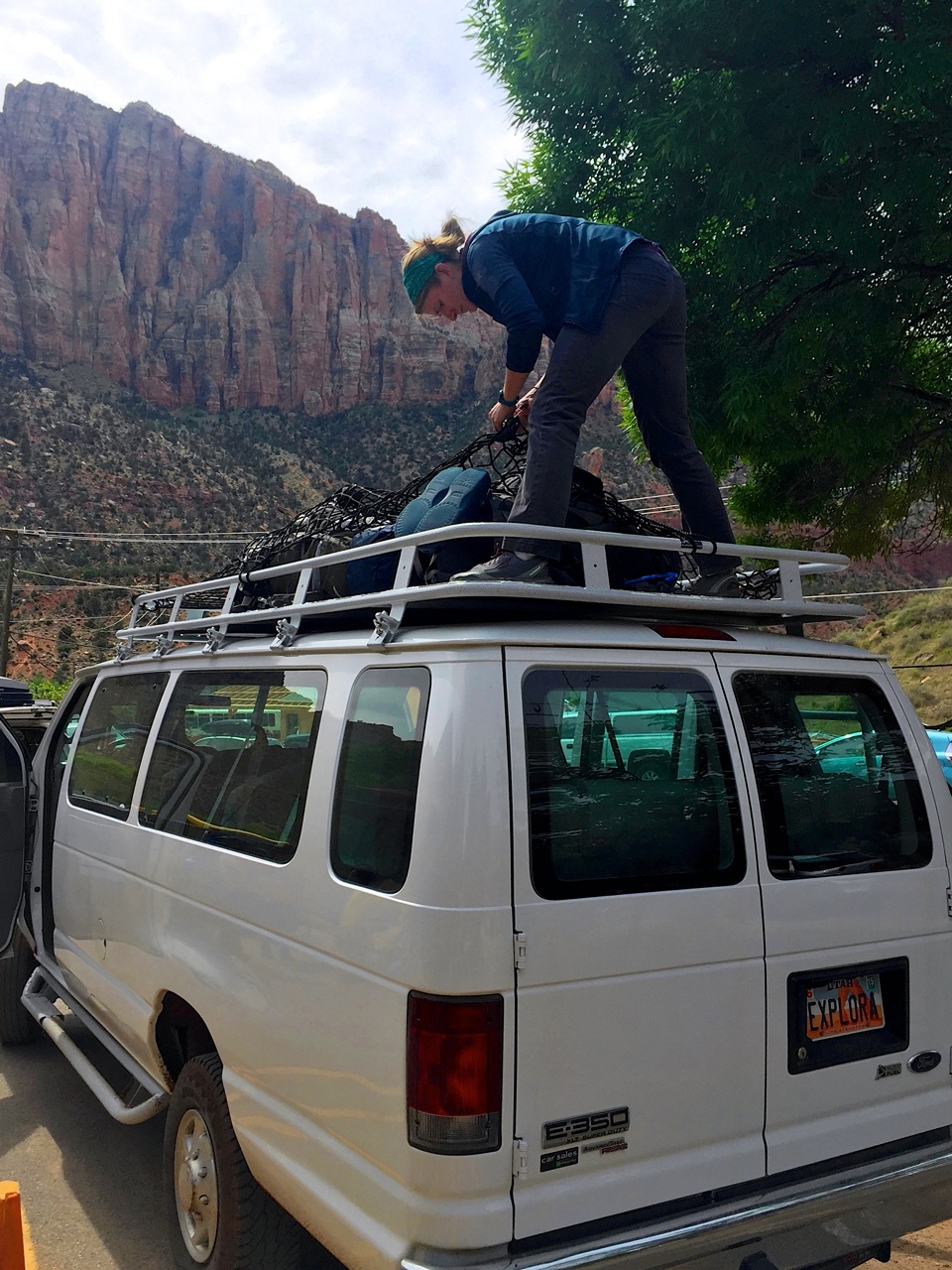
The next step was to reserve flights, a hotel in Las Vegas, a rental car, backcountry permits, campgrounds, and a shuttle to the trailhead. Getting wilderness permit “reservations” online can be a little frantic. Reservations can be made three months in advance starting on the fifth day of every month at 10:00 am Mountain Time. Our trip crossed over two months, so this caused a bit of anxiety; I didn’t want to book flights without being sure we could get the permits we needed. The park office was sympathetic to my plight, but unwavering. So, I applied a bit of magic-dust from my day job at Rare Bird, and wrote a browser script to auto-fill the entire reservation application in a single click. It must have worked because I was able to secure the reservation at exactly 10:00 am Mountain Time. (I checked 30 minutes later and 90% of the online reservations were taken!)
I’m a fairly tolerant eater. Meaning I’ll eat pretty much anything. I happen to know that two of the four are just the opposite. How could we build a meal plan that everyone would be happy with? Fortunately, I had a few ideas and three months to try them out. I decided to use my family as guinea pigs on a camping trip to the Great Smoky Mountains. Nobody has fallen over dead from these recipes, so I figured it was safe enough to use them again. For evening meals, we made grilled pepperoni pitas one night, and bacon jerky macaroni the other. I think both were well received. Breakfast was a hodge-podge of shelf-stable sausage and powdered eggs. (Not as bad as you might think!) Lunches consisted of mini-bagel deli meat sandwiches the first day and PB&J sandwiches after that. We filled in the gaps with high-calorie snacks and nuts. By the time we wandered into Springdale, we were ready for beer and burgers. Our friendly shuttle driver recommended Oscars, which lived up to expectations.
Day 0 - Las Vegas
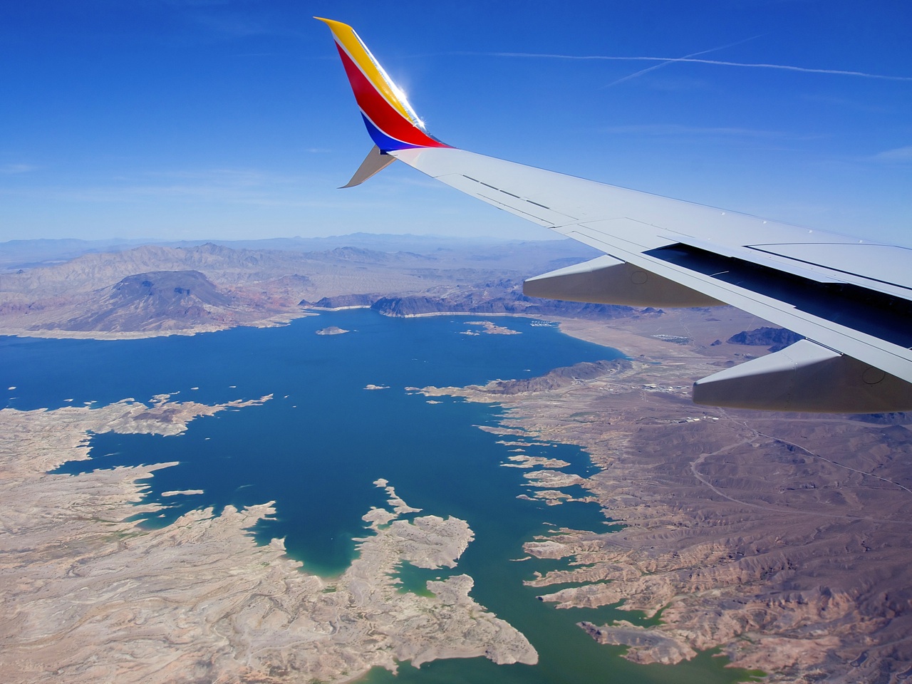
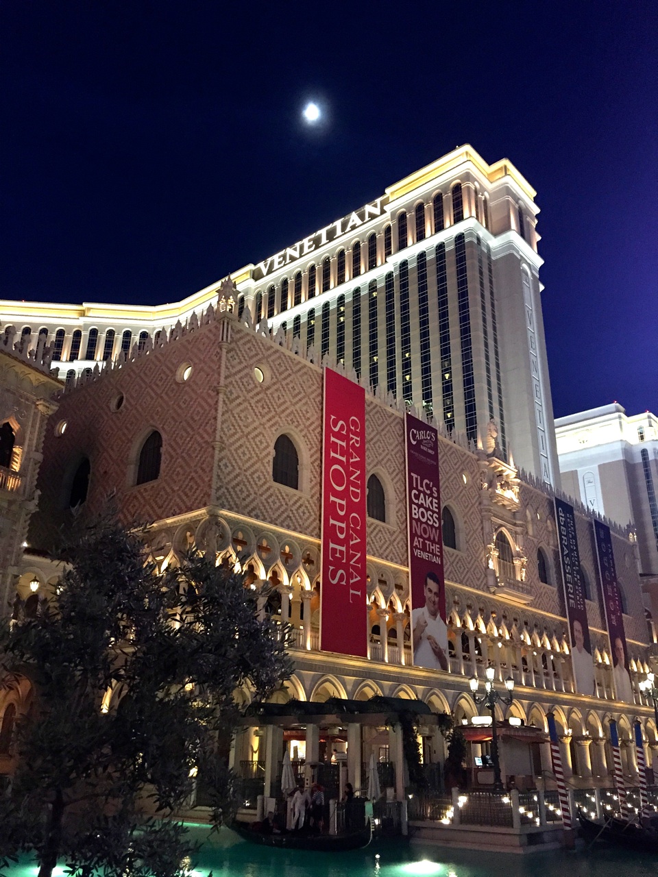
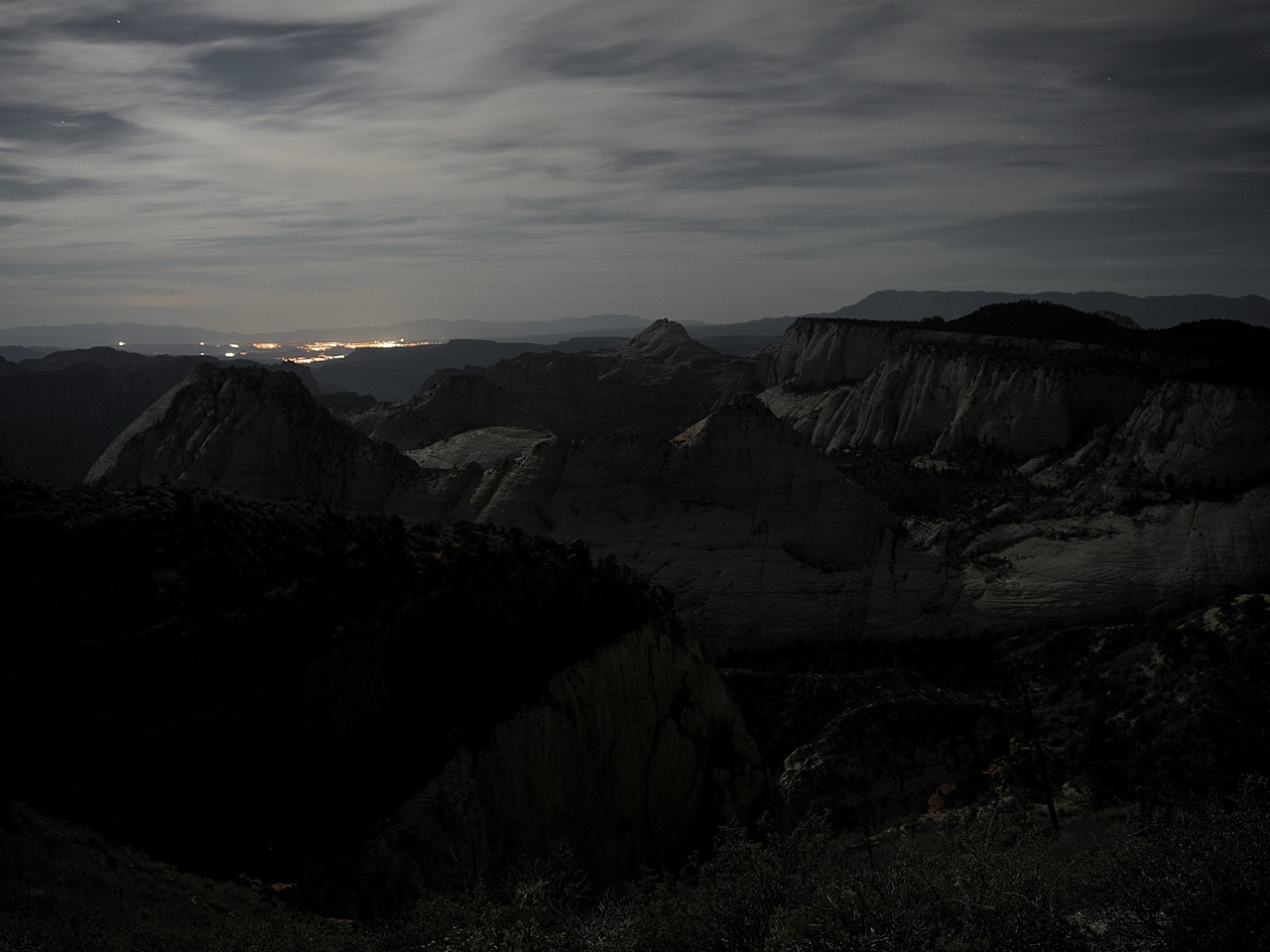
We caught an evening flight to Las Vegas, but with the time zone change we had just enough time for a grocery run. And, an hour or two of blackjack and craps, of course. Turns out there was a big event going on — the boxing match of the century, or something like that. And, while the city had not yet reached it’s climax, the crescendo was palpable. Nevermind that we had to leave at 5:30 am to catch our shuttle to the trailhead. Needless to say, nobody got a lot sleep. This would become a recurring theme.


Tip: Click to enlarge. Use the 'Left' and 'Right' arrow keys to navigate the gallery.
Day 1 - Hop Valley trailhead to the Northgate Peaks
Our schedule out of Las Vegas started with the tolerance of Swiss watch:
| 4:30 am | — shower and pack |
| 5:30 am | — leave Las Vegas, NV |
| 8:30 am | — arrive in St. George, UT (timezone change), Darren meets his client |
| 9:00 am | — leave St. George, UT |
| 10:00 am | — arrive at ZNP Visitor Center, obtain permits |
| 11:15 am | — park car at Zion Adventure Company, board shuttle |
| 11:30 am | — shuttle to Hop Valley trailhead |
| 12:30 pm | — stranded 25-miles from the trails-end! |
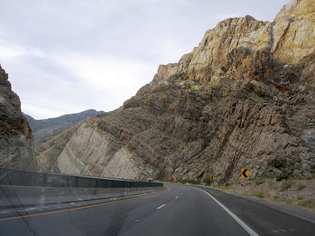
See, ZNP decided this would be the year they would rebuild the Kolob Terrace Road; the only route to our trailhead. A brief window was open from noon to 1 pm. Miss it and you might not get through until after 6 pm. We also had to allow enough time for the shuttle driver to return via the same one-lane road during the same window. Somehow, someway, we absolutely nailed this schedule, and by 12:30 pm we said goodbye to Hayley from the Zion Adventure Company as she dropped us off and drove away.
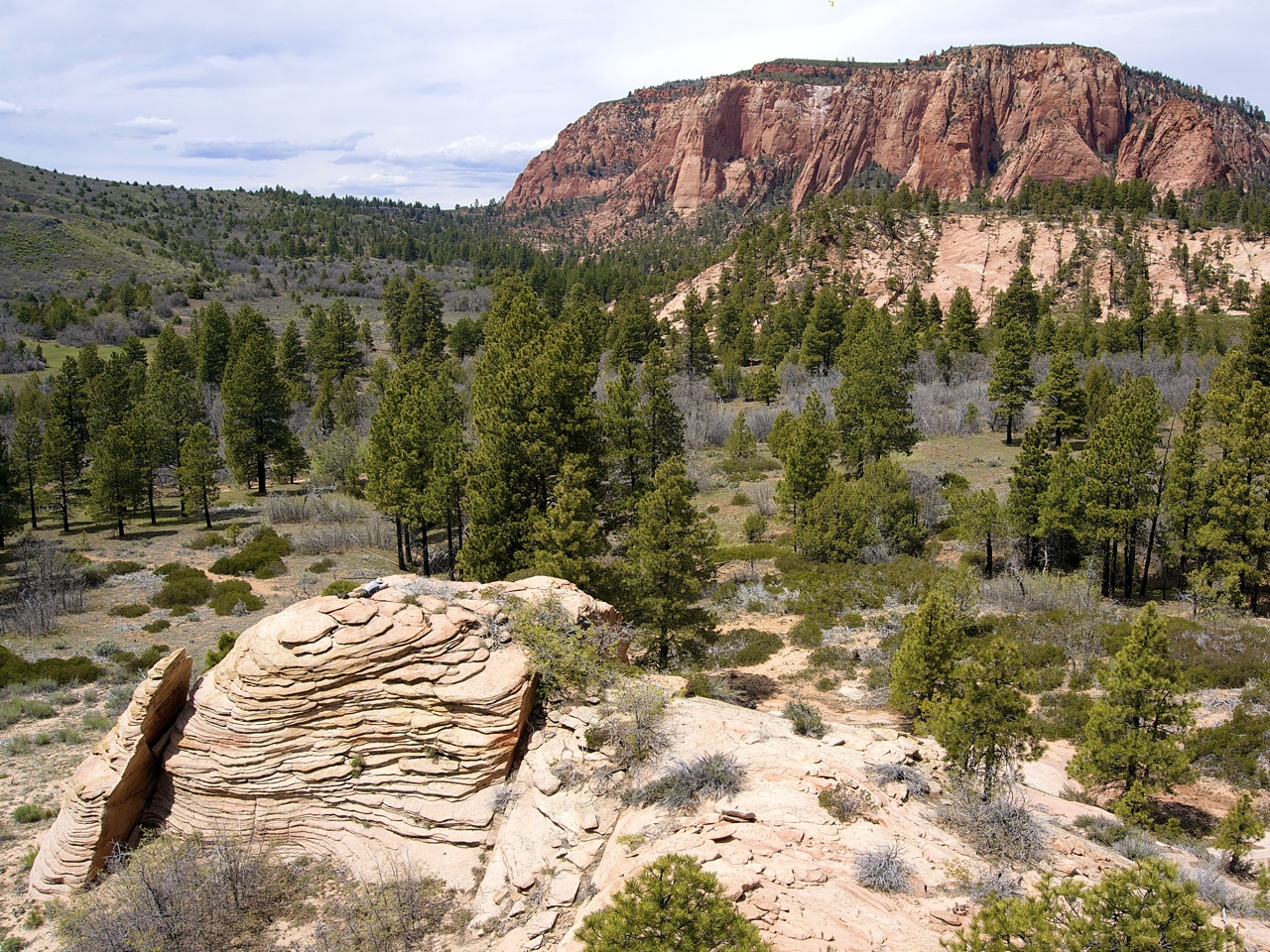
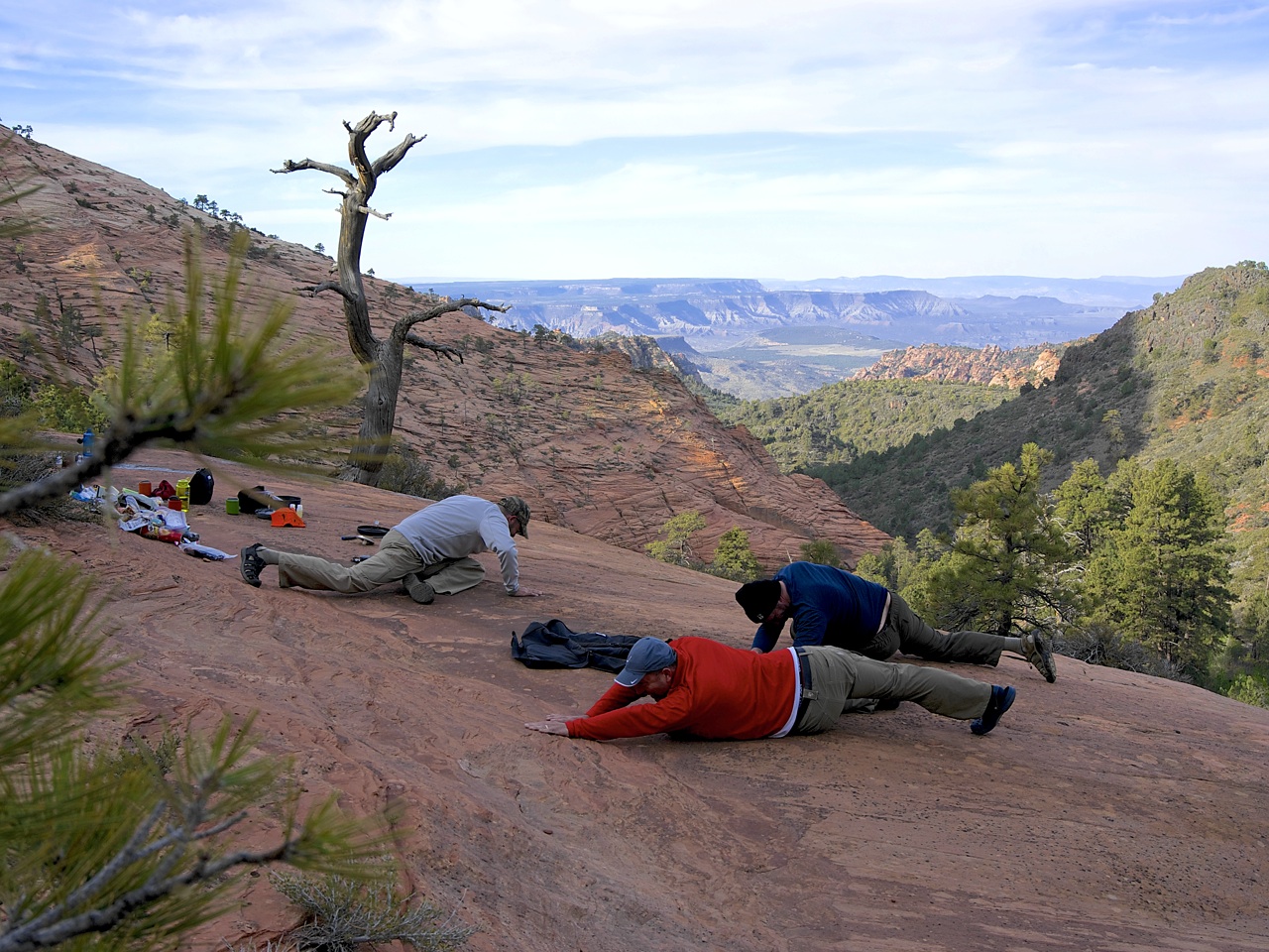
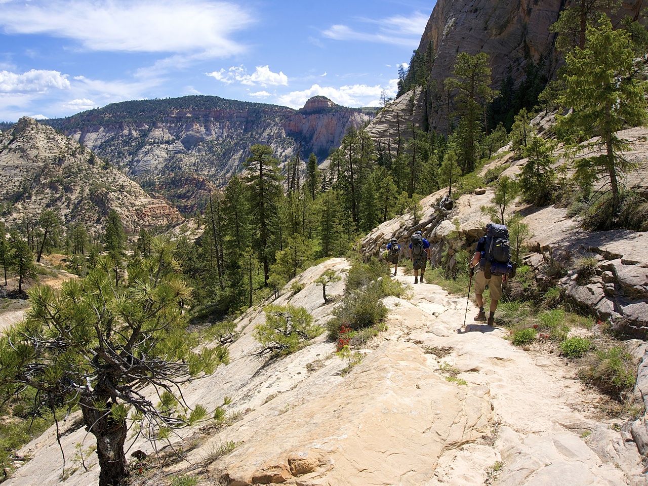
There was nothing to do but start walking. Within the hour we had seen our first snake (not poisonous) among rolling hills leading to deep canyons in the far distance. We passed through wide expanses of desert sage and valleys of ponderosa pines. A rocky outcropping at the bottom of a dry wash provided a welcome break and the first of many cat-nap opportunities for Chad. The rest of us scrambled up the base of Pine Mountain and marveled at the peculiar rock formations.

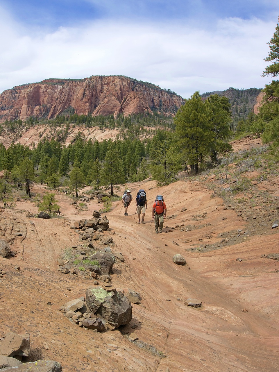

Shortly after getting back on the trail we encountered another hiker. I didn’t get his name — I’ll call him Wyatt because his handlebar mustache belonged to another era. The fact that he was carrying a 14-point mule deer rack just added to his aura. Wyatt was a local, and suggested that we could go off-trail south of the Northgate Peaks to find water and dangle our feet over the edge of what he declared, “some awesome shit.” Sounded great, we were already thinking of camping in that general area. What could possibly go wrong?
For starters, on the map, the western peak looks tiny. Like something you could circumnavigate in 30 minutes. Even staring straight at it, you’re left thinking 45 minutes, tops. Wrong. An hour later we were only half-way around, bruised and scraped, and wondering if we missed a turn. After another 30 minutes we finally found the water pools we were looking for — all but evaporated in the desert sun. Good thing the sun wasn’t setting. Oh, wait.
We sent Chad up a 45° degree incline in search of something flat enough to pitch our tents on. He found a couple of choice spots in a shady grove of pines within an arm-length of the vertical walls of the western peak. We cooked on a nearby ledge of exposed rock overlooking the Great West Canyon. We even found a suspect water source nearby. In retrospect, I wish I hadn’t used this water since it clogged up my filter to the extent that Hans and Franz could now use the pump as a training device.
Day 2 - Northgate Peaks to the West Rim (Campsite #6)
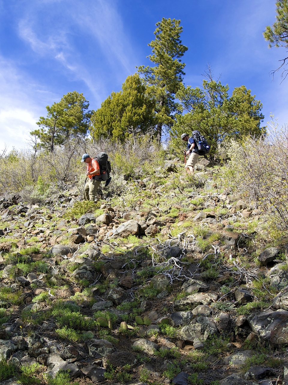
A new environment and new roommates made for another sleepless night, but at least everyone got an hour or two of sleep. We still had to bushwhack our way back to a proper trail, so after a round of coffee and breakfast we headed out through dense sage hoping that the hidden rattlesnakes didn’t like humans. We followed dry creek beds until we found a game trail that led us to a larger trail which ascended back to the peaks overlook. We never did find the elusive feet-dangling utopia. Maybe next time.
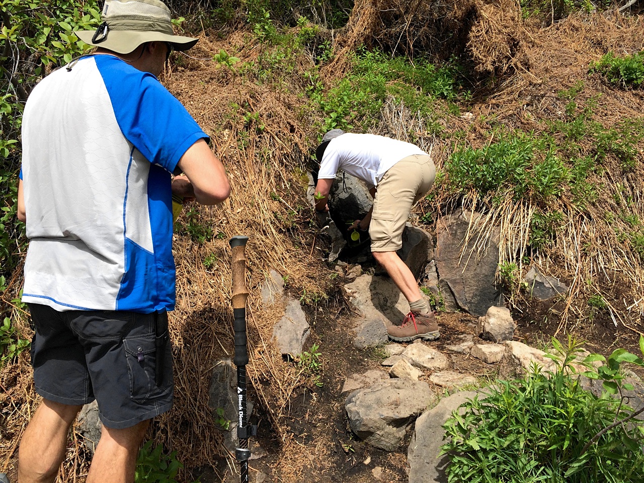
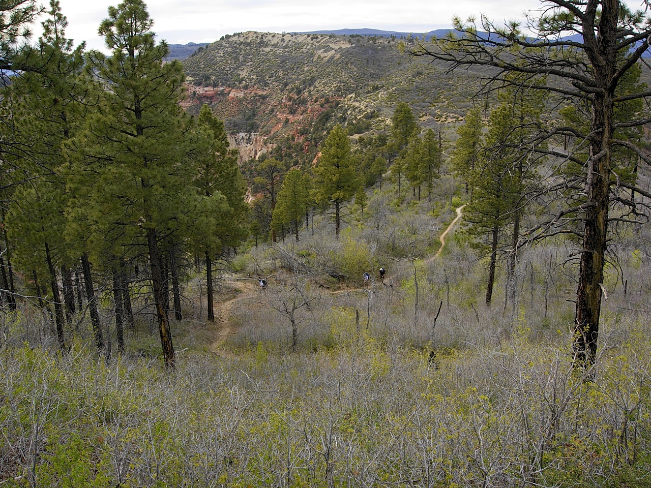
From here we had a 5-mile walk along the picturesque Wildcat Canyon trail to our first official water source. We passed through a scenic section of dense forest that felt like it belonged in the Pacific Northwest rather than Southern Utah. I’m not sure what I was expecting, but the water source at Wildcat Canyon was smaller than I thought it might be. Chad must have felt this way too, so he scouted ahead just to be sure we weren’t missing a bigger pool. He was back inside of 10 minutes and reported that there was in fact a larger pool further down the trail. Darren and I packed up to use that source. 20 minutes later we reached the head of Wildcat Canyon. It was bone dry. Confused, we thought it must be just ahead. After another 10 minutes we still hadn’t found it, so we dropped our packs and back-tracked. We found Chad and Matt just finishing up next to a hidden pool we both had walked right past. “Hey, where did you guys go?” fell on deaf ears.
A quick aside: Refilling water after being empty offers both an extremely high and low feeling. You’re euphoric that you've extended your life until the next source. But, you’re dejected the moment you buckle your pack and realize that 5-liters of water weighs 11-pounds.

Our next human encounter was with a couple of park rangers. I didn’t get names here either, so I’m going with Ranger #1 and Ranger #2. Ranger #1 was on top of her game. She was friendly with an air of authority. She did ask us to show our permits, but she also provided a few points of local knowledge: How far to Lava Point? (Far.) Is it worth the climb up? (No.) Is there water at Sawmill Springs. (A trickle.) It’s amazing there is any water at all on the plateau. (An observation.) You’ll love your campsite on the West Rim. (A promise.)
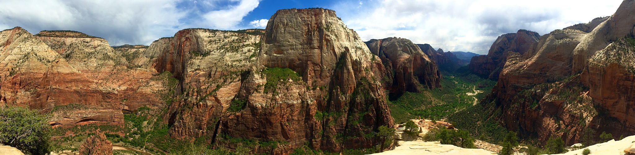
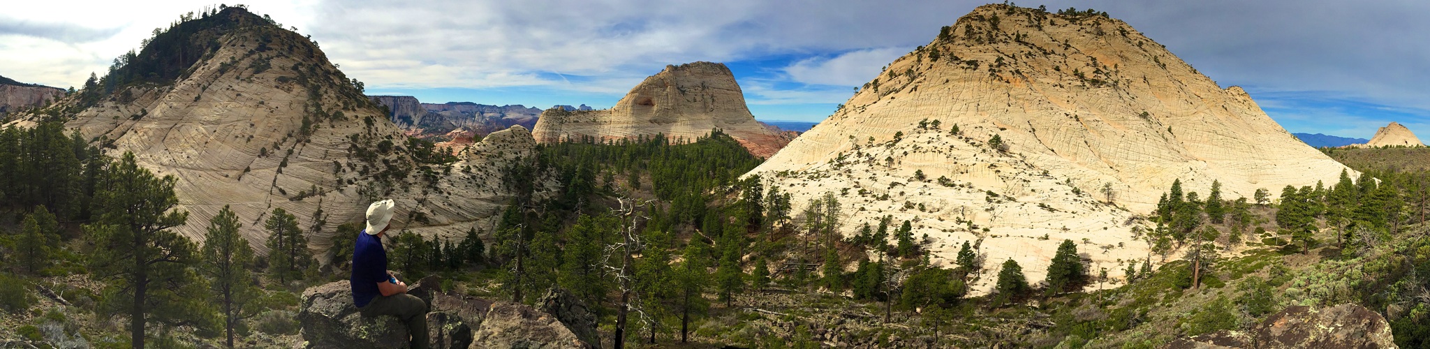
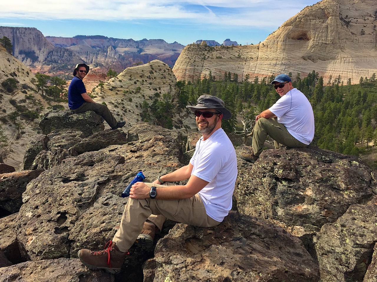
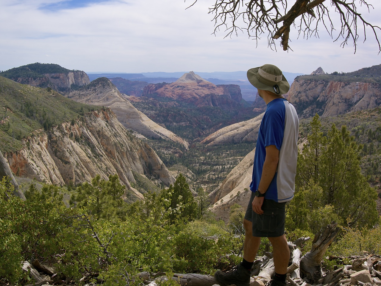
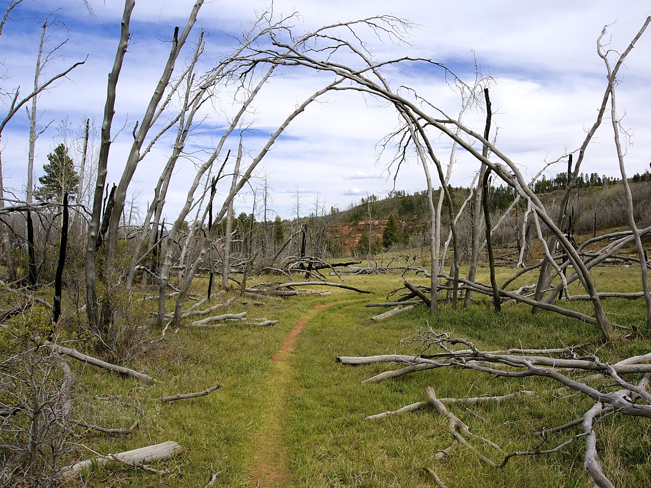
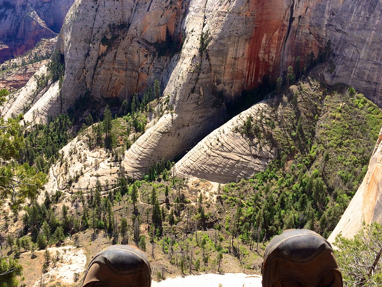
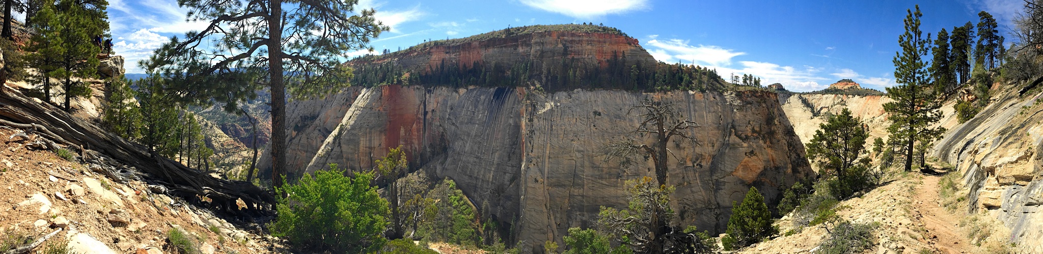
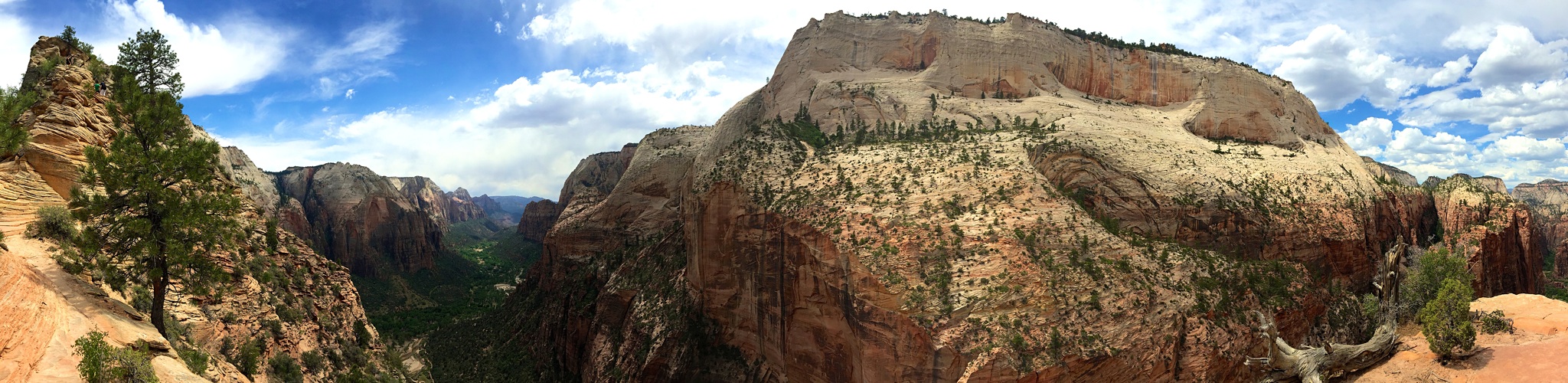
Horse Pasture Plateau serves up a mix of desert scrub with a few junipers and Ponderosa pines scattered about. The area was ravaged by fire in 2009 and charred stumps are dispersed throughout the landscape. This terrain continues south from the Wildcat Canyon/Lava Point junction for 3-miles before a shocking vista presents itself, seemingly out of nowhere. Literally, breathtaking. Darren and I were first to arrive and were still picking up our chins when Chad and Matt rolled around the corner. Then we relived it once again through their reaction. I have no idea why this overlook isn’t marked on the map! It should be on all of the promotional material that ZNP produces. The South Guardian Angel is positioned perfectly amongst the towering walls of the Great West Canyon. If a single shaft of sunlight were to hit the mountain, I would have told you that Mount Sinai was in Utah.


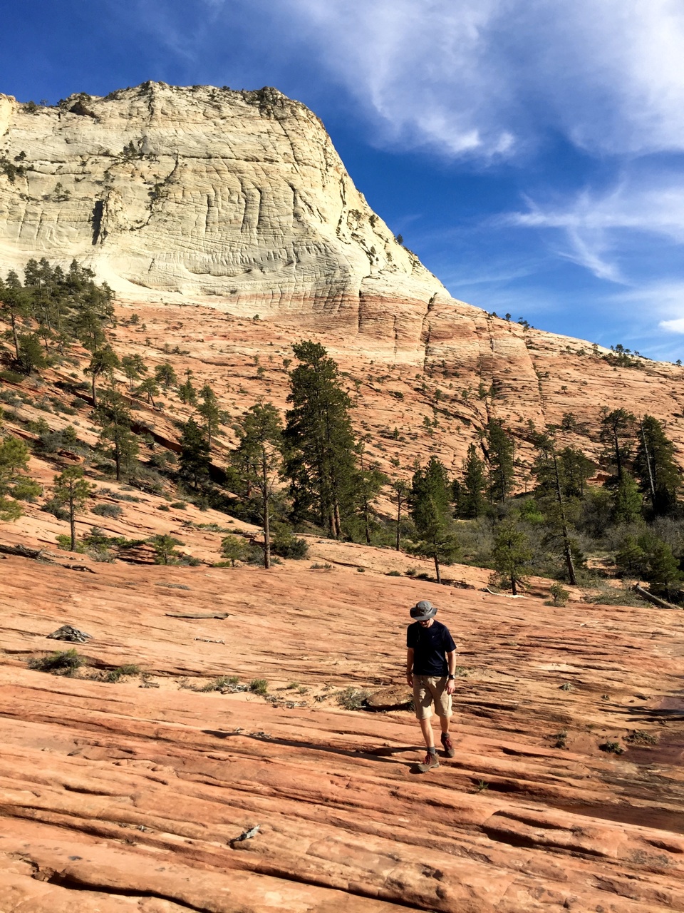
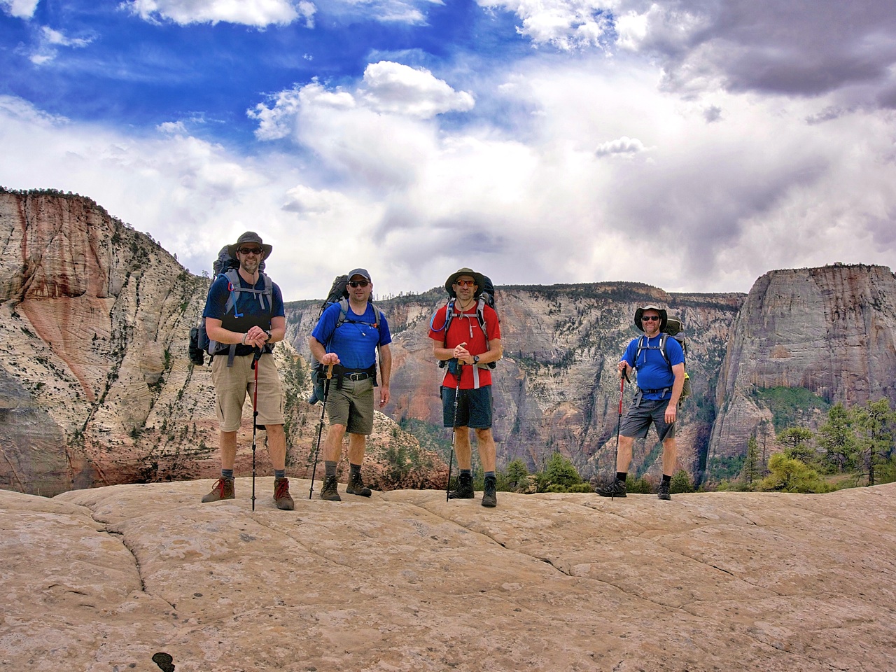
It was hard to move on from this place, but we still had a few more miles to go before we reached our campsite. We passed through scenic Potato Hollow before arriving at the first of three “humps” the ranger warned us about. For the record, a “hump” in Utah would pass as Mt. Everest in Indiana. Campsite #6 sits high atop the West Rim with nearby overlooks north to Horse Pasture Plateau and west to Phantom Valley. Trail weary after 13-miles, we just sat. Finally, under a setting sun and rising moon, we made camp and then dinner.
Day 3 - West Rim to The Grotto (Zion Canyon)
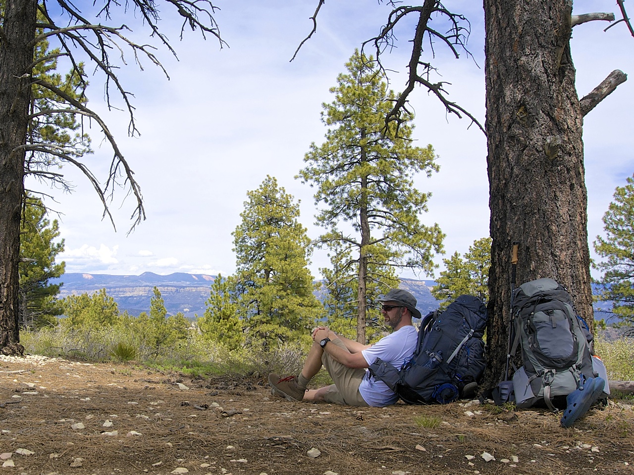
In theory, our third day was supposed to be the easiest. The majority of the trail was downhill, and we didn’t need to log double-digit miles. But, the long hike to the campsite the previous day had us running low on water and sacrifices had to be made. No coffee (yikes!) and no milk for cereal. We divvied up our remaining water (1/2-liter each) and hoped that we could hold out until the next spring, 3.2-miles away.

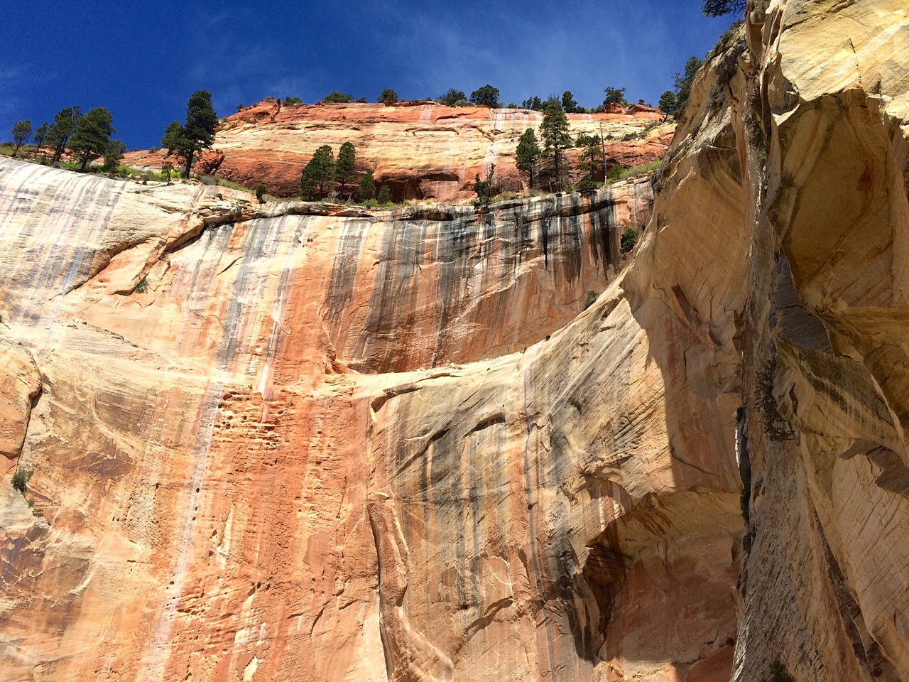

We made it to the spring on empty and refilled our water with a number of other hikers. Cabin Springs sits high above Telephone Canyon. A scant 20-feet from the spring, a cliff drops precipitously at least 500-ft straight down. Darren thought it would be a good idea to perch over the edge and take a photograph. He wasn’t going to get any help from us, so if he wanted that photo, it would need to be a selfie. Turns out my camera wouldn’t have been much help anyhow. Somewhere between the top of the West Rim and Telephone Canyon, the memory card became dislodged. The camera was going through the motions of taking pictures, but they weren’t being saved. I’m really sick about it, however these scenes will live on in my memory.
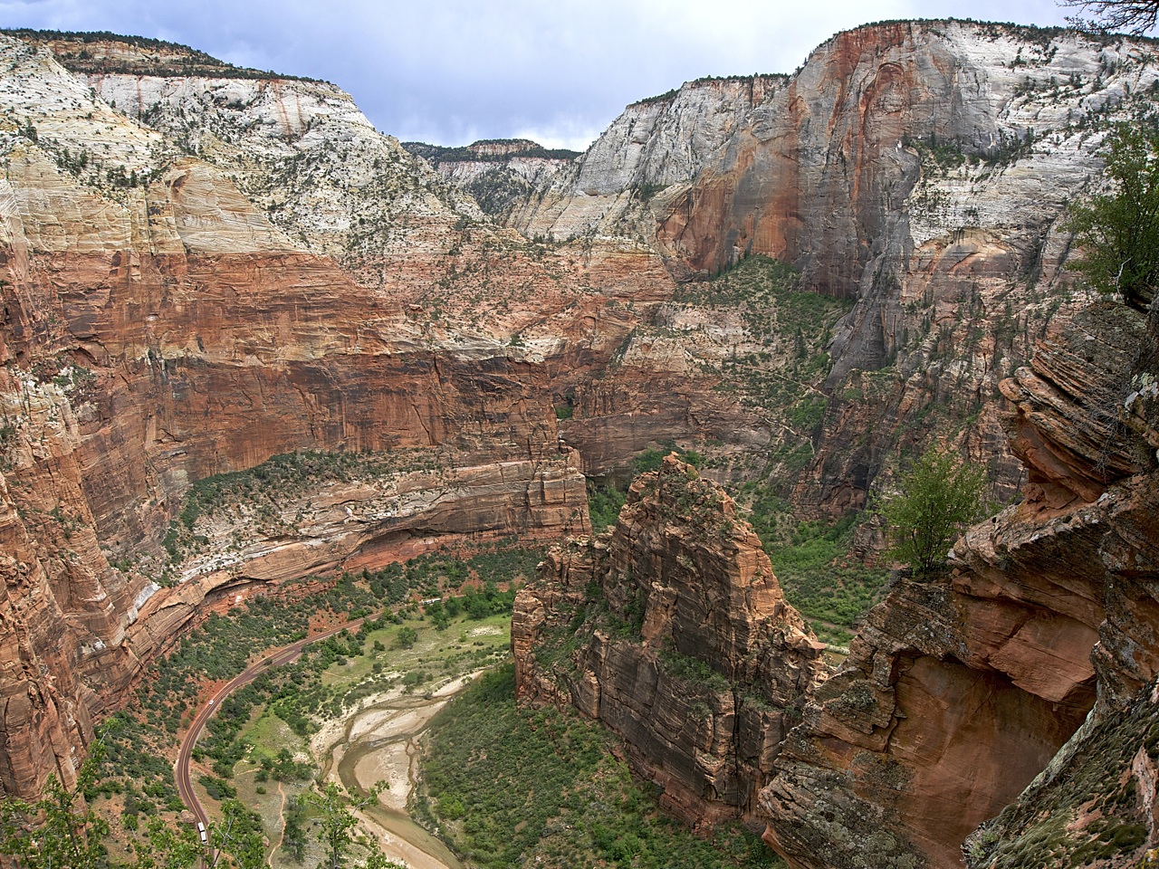
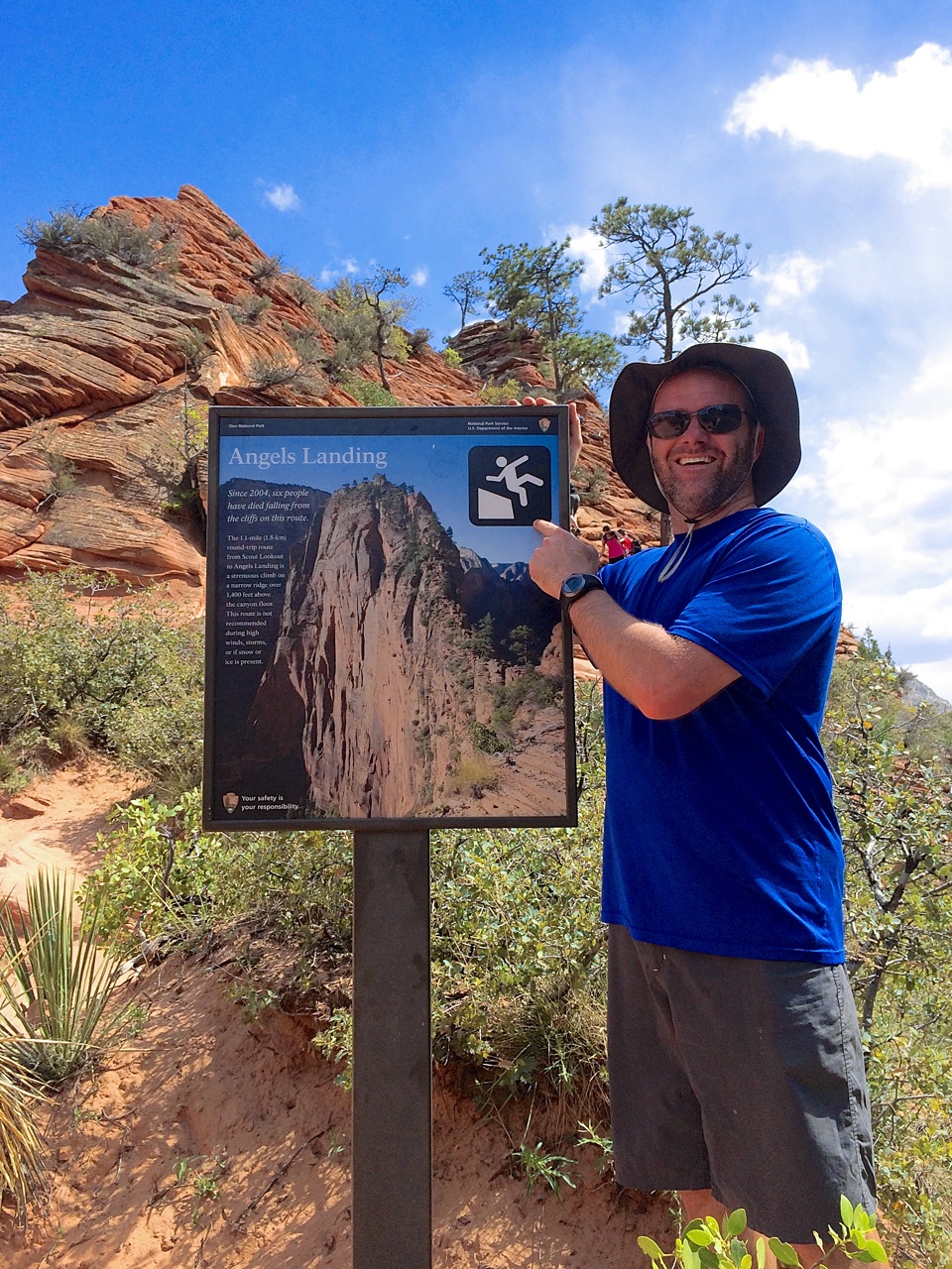
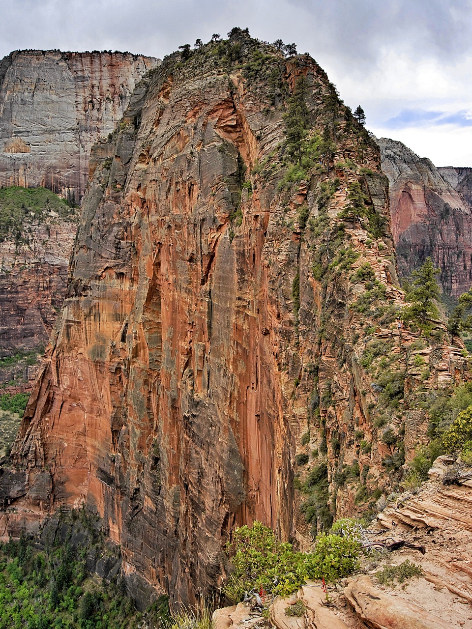
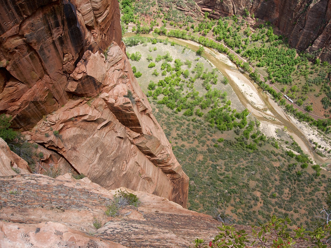
We loaded up on another 5-liters of water and set out on the last leg of our trek, south towards the canyon floor. But first, we would be passing by Angels Landing — one of two quintessential hikes in the park. The original plan called for a day hike of Angels Landing on Day 4, but after realizing we would have to retrace 2.4-miles of switchbacks climbing 1,500-ft just to get to it, we opted to squeeze it in on our way down. Angels Landing did not disappoint. This majestic rock spire juts into Zion Canyon with panoramic 360° views from the summit. Support chains are anchored into the rock face for the last half-mile to the top. Steep does not describe this trail. Harrowing comes closer, but still isn’t the right word. It simply must be experienced. Go!


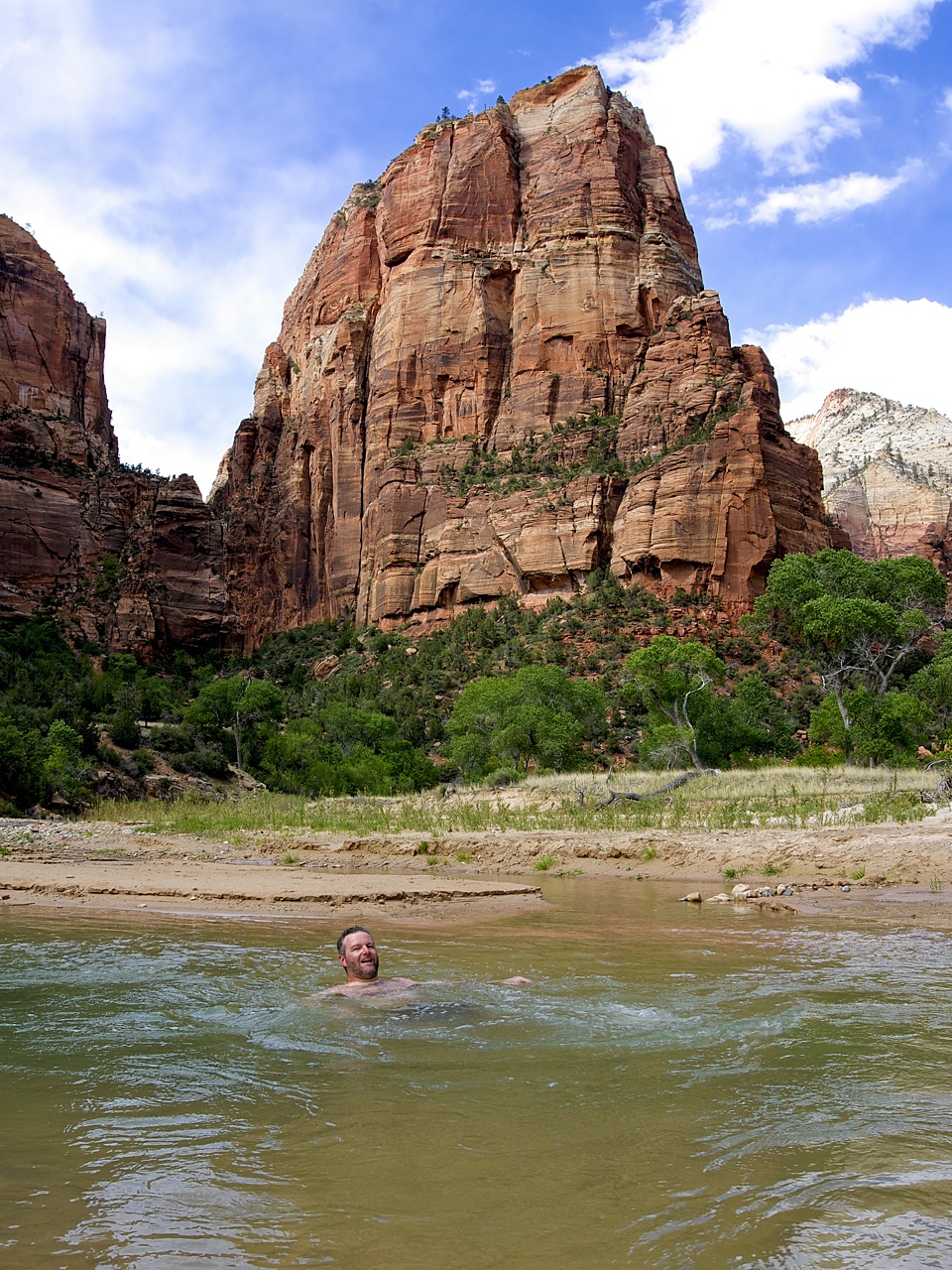
I’m still recovering from the aches of hiking down Walter’s Wiggles with 35-lb packs. My feet were on the cusp of blistering before the descent. By the time we reached the bottom, they were doomed. We had a few hours of daylight left, and our agenda called for a shower, making camp, and dinner. Not necessarily in that order. It was hard not to notice the Virgin River meandering a 100-yards from our trail. Shower… check. Freshly bathed, we sent Darren for the car, while we checked into Watchman Campground and set up our tents for the final time. Then, it was off to Springdale for some grub.
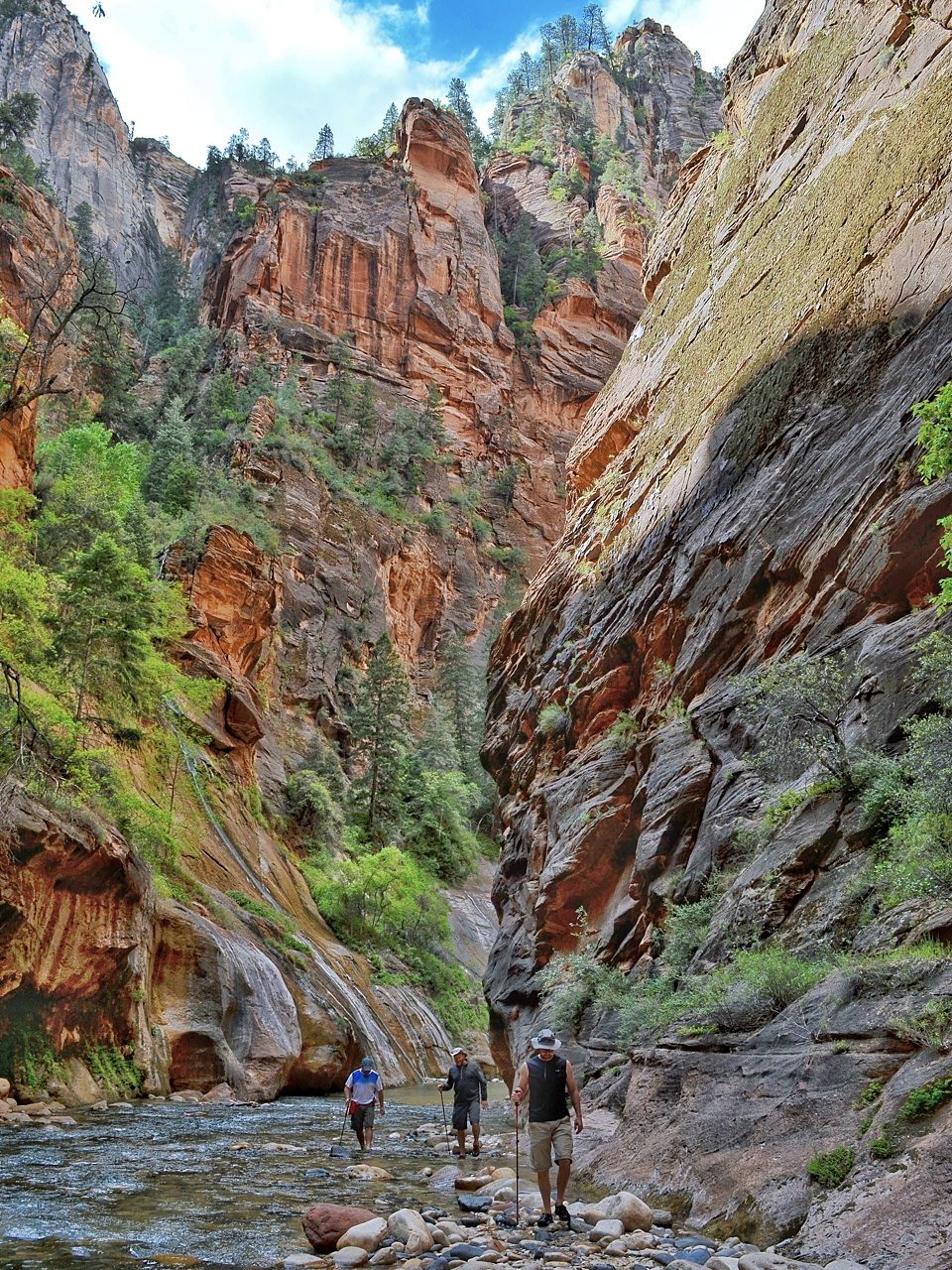
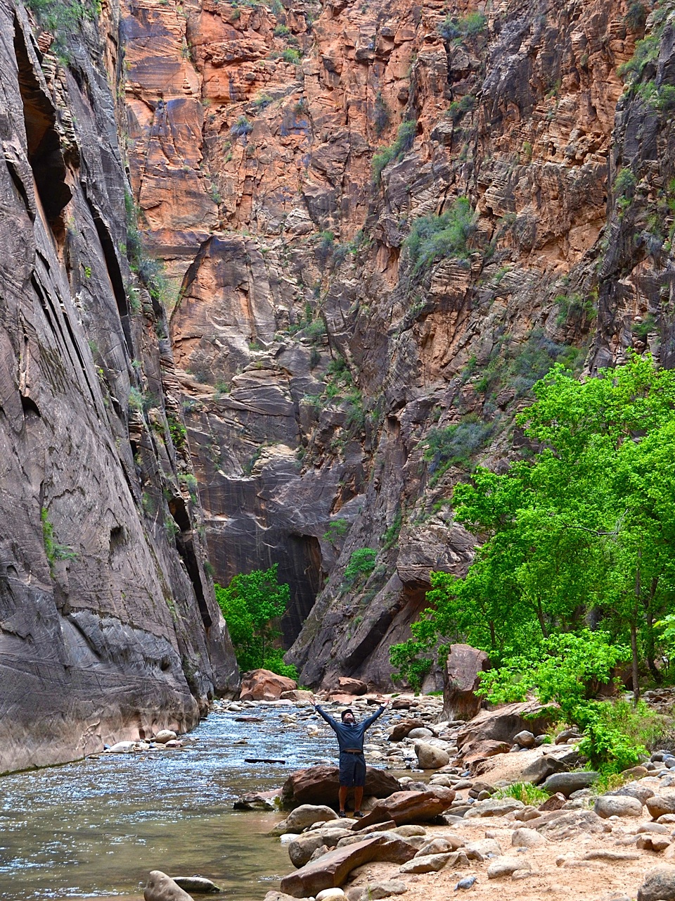
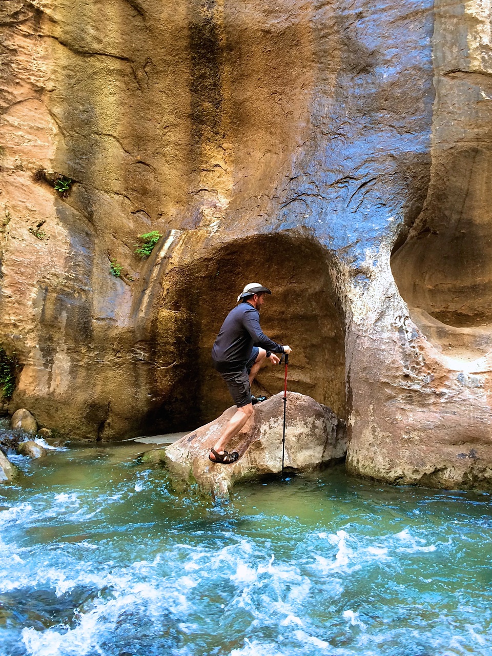
Day 4 - The Narrows (day hike)
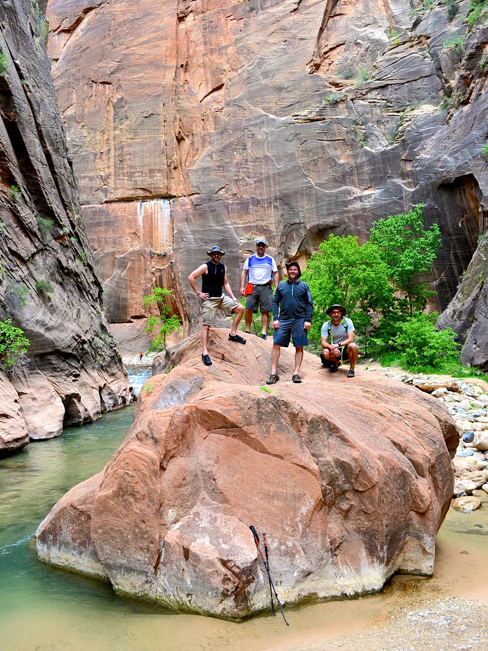
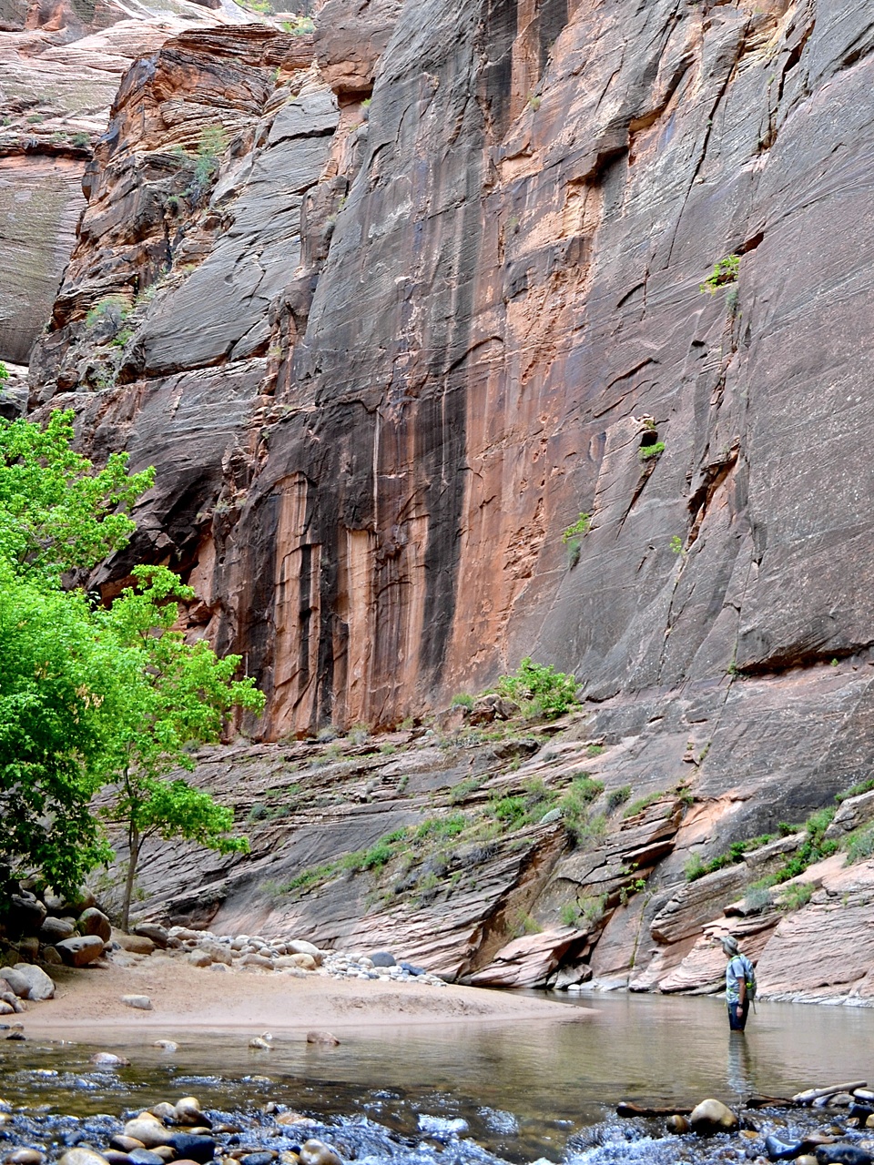
With Angels Landing checked off of our bucket lists, we had just enough time left for one more legendary hike. The Narrows follows the Virgin River upstream from the Temple of Sinawava for 16-miles. Typically, the hiking season on this trail is only in the summer and autumn due to the high water levels from the winter snows. But this year, drought conditions have allowed the trail to remain open. We didn’t have time for a complete trip to the top, but we pushed as far as we could before turning around to catch our red-eye flight back to Indianapolis. Should I ever come back, this hike will be at the top of my list.

With our batteries recharged, we returned to Las Vegas to catch our flight home. This time, Las Vegas was winding down from the Mayweather/Pacquiao bout, and the airport was extremely congested. An hour wait on the tarmac made for an even later arrival.
Overall, I wish we would have seen more wildlife in the backcountry — we only saw a few snakes and lizards. It wasn’t until we were amongst the throngs of park visitors in the main canyon that we began to see bigger animals like mule deer. I have unscientifically concluded that it must be easier to take the food from humans, rather than forage. I would highly recommend Zion National Park to anyone. The scale, biodiversity, and beauty of the park are unmatched. Jules Renard had the right of it when he said, “On Earth there is no Heaven, but there are pieces of it.” I found a few pieces in Zion.
* We have conflicting GPS and FitBit data with regards to the exact miles walked and number of steps taken. One thing is for certain. My body aches like I walked 107,174 steps and 30-miles, so that’s what I’m going with. After backpacking in Alaska and now Utah, I’ve learned that one mile west of the Mississippi does not equate to one mile east of it. Strange, but true.
What others are saying...